


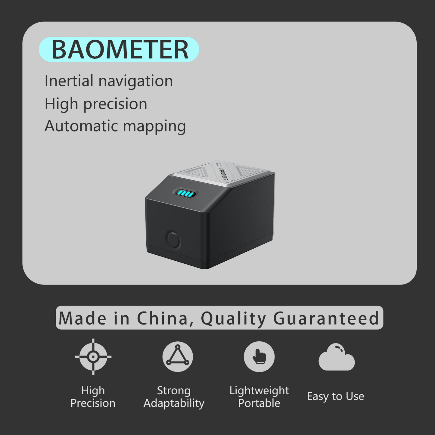
BAOMETER
BAOMETER
【BAOMETER】It can measure even without satellite signal
- Pipeline, tunnel, mine, landscape, garden and other industries
- The results include CSV, CAD, and PDF formats
- Combination of high-precision RTK and inertial navigation module
 30-day money-back guarantee
 1-year warranty
Couldn't load pickup availability
50 in stock
Details and Features
Details and Features
Baometer is a portable device that integrates high-precision RTK and high-precision inertial navigation module to solve the problem of unable to measure normally in the case of signal discontinuity. It can generate real-time maps and automatically produce measurement results through the accompanying software.
Specifications
Specifications
Product Name: Baometer
Product model: BT-BZ1
Net weight of the product: approximately 220g
Product size: 3.54*2.48*2.28in
Working temperature: -10 ℃~+50 ℃
Storage temperature: -20 ℃~+70 ℃
Interface type: Type-C
Battery Type: Lithium Battery
Battery capacity: 2500mAh
Battery life: continuous measurement for 7-8 hours
Charging parameters: 5V-1A
Waterproof and dustproof: IP65
Static accuracy: Horizontal: 土(2.5+0.5 × 10⁻⁶ ×D) mm
Vertical: 土(5+0.5 × 10⁻⁶ ×D) mm
RTK accuracy: Horizontal: 土(8+1.0 × 10⁻⁶ × D) mm
Vertical: 土(15+1.0 × 10⁻⁶ × D) mm
Measurement range: Acceleration: ± 4g
Angular velocity: ± 1000 °/s
Package contents
Package contents
- 1x User Manual
- 1x certificate of conformity
- 1x warranty card
- 1xUSB charging cable
- 1x pea pod
- 1x mobile phone holder
- 1x fixture bottom storage
- 1x measuring rod
- 1x Baometer
Asked Questions
Asked Questions
- 1-year warranty;
- Scan the QR code to download the software;
- Manually enter the CORS account;
- We are here to assist you! Please visit our "Contact Us" page to get in touch with us.


High-precision measurement across all scenarios
By integrating RTK and inertial navigation technology, it supports satellite signal discontinuous scenarios such as indoors, tunnels, mines, high-rise buildings, and forest areas, achieving centimeter-level positioning even in the absence of signals.

Intelligent and convenient operation
The accompanying software automatically connects to Bluetooth, provides voice prompts to guide the operation, adapts to complex environments, and starts testing immediately after power-on, without requiring professional training.

Photography and data management for evidence preservation
On-site photos can be taken and stored by category, facilitating the management of engineering archives. The data can be wirelessly transmitted to a computer for further processing.

Widely applicable industries
Covering multiple government departments such as land, transportation, water conservancy, agriculture and forestry, emergency response, and cultural tourism, as well as enterprises in surveying and mapping, landscape, and mining, it is a versatile machine that can be used across the entire industry.

Replace traditional complex measurement methods
In scenarios where total stations cannot be used, such as in box culverts, underground wells, and narrow spaces, it replaces "speculative" measurement and achieves precise data collection.